This blog explains the Dwarka Expressway route map with sectors and interchanges in plain language. No technical jargon. No brochure-style promises. Just how connectivity works on the ground.
What Is Dwarka Expressway?
Dwarka Expressway, officially called the Northern Peripheral Road (NPR), is a high-capacity road created to directly connect:
- Dwarka, Delhi
- New Gurgaon
- NH-48 (Delhi–Jaipur Highway)
It was planned as an alternative to NH-48, which had become overloaded years ago. Anyone travelling between West Delhi, South-West Delhi, and Gurgaon knows how unpredictable that highway can be.
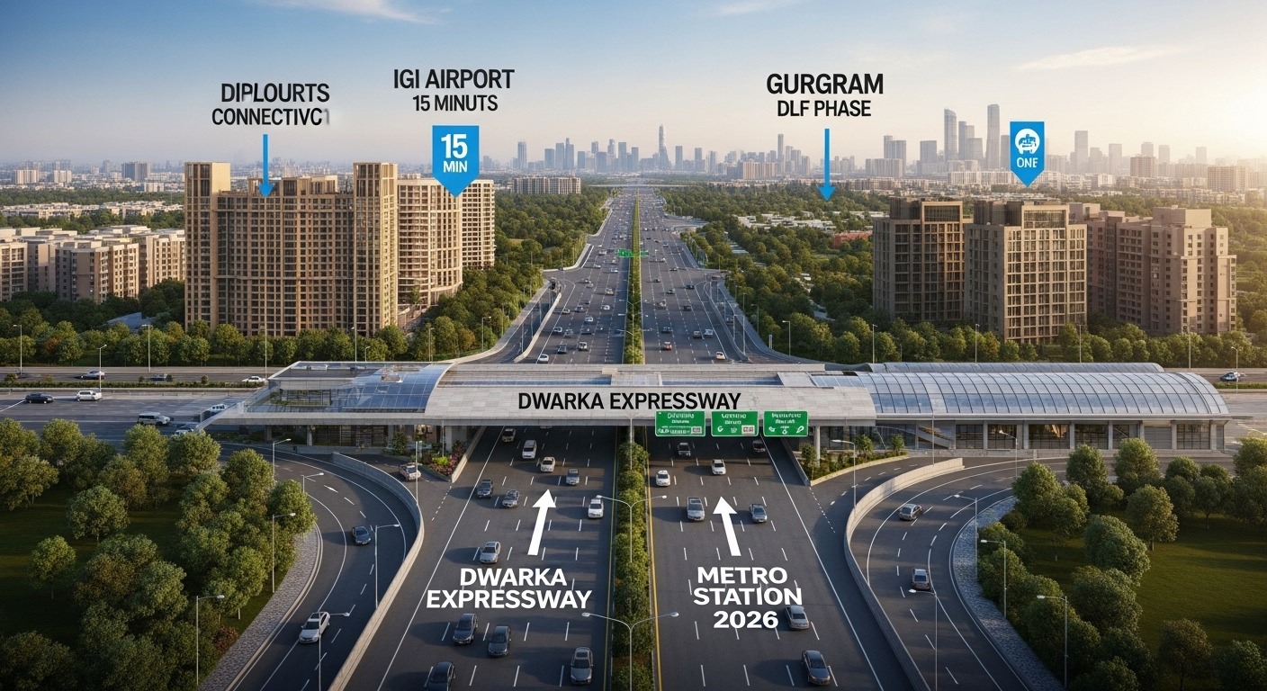
Instead of forcing all traffic onto one corridor, the Dwarka Expressway spreads movement across a parallel route. The goal isn’t just speed — it’s reliability
Dwarka Expressway Route Map: The Big Picture
If you look at the route map, the expressway forms a clean diagonal link between Delhi and Gurgaon.
In simple terms, this is how it runs:
- Starts near Dwarka Sector 21 on the Delhi side
- Runs almost parallel to NH-48
- Passes through several New Gurgaon sectors
- Ends near Kherki Daula / Manesar, where it reconnects with NH-48
The total length is around 29 kilometres, with roughly:
- 18 km in Gurgaon
- 11 km in Delhi
But the real strength of the Dwarka Expressway isn’t its length. It’s how the interchanges are placed and how smoothly traffic can move through them
- Dwarka Expressway Route Map With Sectors (Gurgaon Side)
Understanding the sectors is important because this is where daily life actually happens.
On the Gurgaon side, the Dwarka Expressway runs close to or through:
- Sector 102
- Sector 103
- Sector 104
- Sector 106
- Sector 109
- Sector 110
- Sector 111
- Sector 112
- Sector 113
Together, these areas are often called the Dwarka Expressway belt or New Gurgaon.
What sets these sectors apart from older parts of Gurgaon is planning. Roads are wider, access points are more controlled, and service lanes are built into the layout. That planning shows up in everyday movement.
Connectivity Benefits of Dwarka Expressway to Delhi–Gurgaon
Now let’s talk about what actually changes once you start using it.
- Reduced Dependence on NH-48
Earlier, almost all Delhi–Gurgaon traffic depended on NH-48.
The Dwarka Expressway provides:
- A parallel corridor
- Lower congestion pressure
- More predictable travel times
This is one of the biggest connectivity benefits Dwarka Expressway to Delhi Gurgaon offers.
- Faster and More Reliable Airport Access
From the expressway:
- Airport routes become shorter
- Traffic-heavy stretches are avoided
- Travel planning becomes more reliable
For frequent flyers, this changes how you plan your day.
- Better Access for New Gurgaon Sectors
For years, New Gurgaon felt distant.
Now, with:
- Direct expressway access
- Multiple interchanges
- Wide internal roads
These sectors feel far more connected to both Delhi and central Gurgaon.
- Smoother Daily Commutes and Emergency Movement
Grade-separated design means:
- Fewer signals
- Fewer sudden stoppages
- Faster emergency vehicle movement
These are small things individually, but together they improve daily life
Why the Route Map Matters for Homebuyers
Many buyers ask only one question:
“Is the project on Dwarka Expressway?”
The more important question is:
“Where exactly is it on the route map?”
Two projects on the same expressway can have very different:
- Entry convenience
- Noise exposure
- Access to interchanges
Understanding the Dwarka Expressway route map with sectors and interchanges helps buyers avoid wrong assumptions.
How Dwarka Expressway Fits Into NCR’s Larger Road Network
Dwarka Expressway doesn’t function in isolation.
It connects with:
- NH-48
- Urban Dwarka roads
- Southern Peripheral Road (indirectly)
- Future metro and transit plans
This integration is why its benefits build steadily rather than overnight.
Common Misunderstandings About Dwarka Expressway Connectivity
Let’s clear a few assumptions:
- “Everything near the expressway benefits equally”
→ Not true. Interchange access matters most. - “Connectivity means instant price jumps”
→ Usability improves first; value follows later. - “Living near an expressway is always noisy”
→ Service roads and buffers make a real difference.
What the Route Map Tells Us About the Future
Route maps show intent.
Dwarka Expressway reflects:
- Long-term traffic planning
- Controlled growth zones
- Stronger Delhi–Gurgaon integration
It’s more than a road. It’s a shift in how the region moves.
Understanding the Dwarka Expressway route map with sectors and interchanges helps separate real usability from hype.
FAQs
- Where does Dwarka Expressway start and end?
From Dwarka Sector 21 in Delhi to NH-48 near Kherki Daula. - Which sectors lie along Dwarka Expressway?
Mainly Sectors 102 to 113 on the Gurgaon side. - Does Dwarka Expressway reduce travel time?
Yes, especially during peak hours. - Is it suitable for daily commuters?
Yes, because of wide lanes and grade-separated interchanges. - Does every project on the expressway benefit equally?
No. Proximity to interchanges and service roads matters most.